Early Sunday morning I left Nuremberg for a trip to Schnaittach and the Rothenberg fortification (draft of a Google map), located 25 km northeast of Nuremberg and 561 m high, a south tip of Franconian Switzerland. Warm weather and little west wind, perfect conditions. Via Behringersdorf, Rückersdorf, and Lauf a.d. Pegnitz I reached Neunkirchen a. Sand around 10 o'clock, where I took the first photos today; church with two towers, a castle like arrangement.
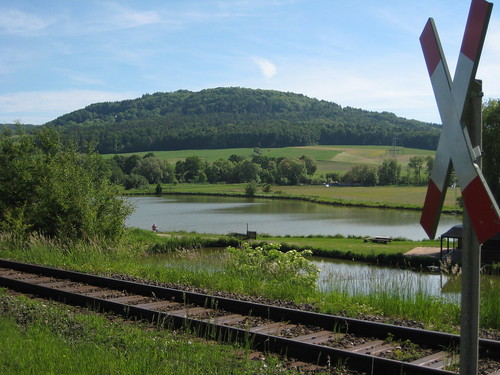
Nice passage through a small forrest and plain fields with the Rothenberg castle at the horizont, eastwards in front of me. I could not resist and took short videos (train crossing my way, birds making noise, and the Rothenberg). The Rothenberg fortification in its current extension was constructed by the Bavarians against Nuremberg in the first half of the 18th cent. It was never finished and fall into ruins since 19th cent.—today the Bayerische Schlösser- und Gärtenverwaltung spends much money for preservation.
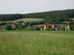 Homewards down the Rothenberg via Rabenshof, Kersbach, Rollhofen, Nürnberger Spitalwald, Simonshofen, (Neunhof, nice view), Oedenberg, and through the Sebald forrest back to Nuremberg.
More photos already posted at flickr.
To be continued.

No comments:
Post a Comment