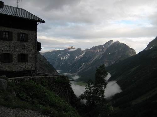
2009-06-28: Karwendelhaus – Birkkarhüttl (2635m) – Birkkarspitze (2749m) – Karwendelhaus – Kleiner Ahornboden – Herzoglicher Alpenhof [– Hinterriß – Lenggries – Nürnberg]
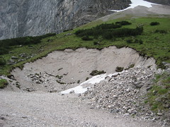
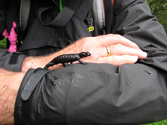
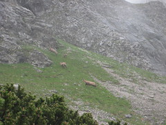
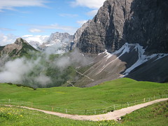
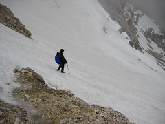
 Finally stopped raining around 6:00–and Mike and me left the hut half an hour later. With one rucksack only we wanted to ascend the Birkkarspitze and, maybe, continue with the Brendelsteig traversing the Ödkarspitzen. Before reaching the Schlauchkar we saw several black alpine salamanders and the chamois herd I already encountered yesterday. We passed the snowfield in the lower Schlauchkar and then ascended aside the snowfield on a stony path, rather exhausting.
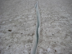
Over scattered rocks and through flowing melt water. Steep snowfield where Mike had to work hard to build treads for us.
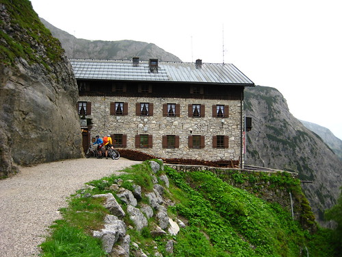
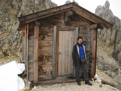 At around 10:00 at the Birkkarhüttl, a biwakschachtel (emergency hut) located in the Schlauchkar Sattel (2635m), good 100m below the summit of the Birkkarspitze. This hüttl offers space for 4 persons spending a night.
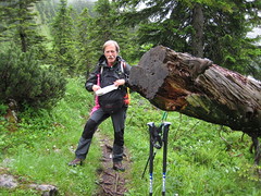
We ate müsli bars, drank water, and took photos. We gave up on the idea doing the Brendelsteig, because it probably would have taken too long, if we'd wanted to catch the bergsteiger bus in the Rißbach valley at 18:00.
At around 10:00 at the Birkkarhüttl, a biwakschachtel (emergency hut) located in the Schlauchkar Sattel (2635m), good 100m below the summit of the Birkkarspitze. This hüttl offers space for 4 persons spending a night.
We ate müsli bars, drank water, and took photos. We gave up on the idea doing the Brendelsteig, because it probably would have taken too long, if we'd wanted to catch the bergsteiger bus in the Rißbach valley at 18:00.
Climbing up to the summit (20 min), snow rests from last week and this night(?) on the path. The path is often secured with wire ropes, but some of them are partially damaged.
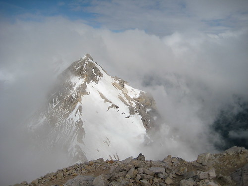
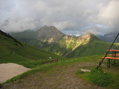
 For some moments it was possible to see the Östliche Ödkarspitze and the ridge to it from the Schlauchkar Sattel. The Ödkarspitzen are nearly as high as the Birkkarspitze.
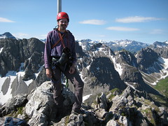
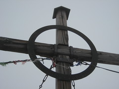
The wooden cross on the summit is also used as a war memorial. Descending was easier, because the snow was softer and mist and hanging clouds were gone. We enjoyed sliding down the snowfields on our hiking shoes!
For some moments it was possible to see the Östliche Ödkarspitze and the ridge to it from the Schlauchkar Sattel. The Ödkarspitzen are nearly as high as the Birkkarspitze.
The wooden cross on the summit is also used as a war memorial. Descending was easier, because the snow was softer and mist and hanging clouds were gone. We enjoyed sliding down the snowfields on our hiking shoes!
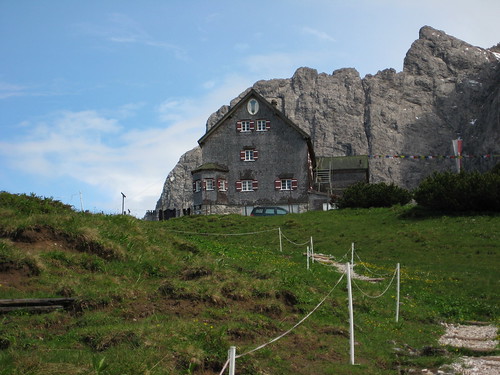
Lunch at Karwendelhaus: Schnitzel (Mieko), Gemüseeintopf (Bergsteigeressen, Mike), Spaghetti mit Tomatensoße (me).

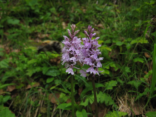
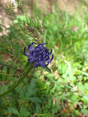
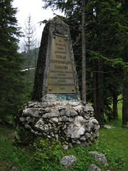 First on MTB route passing the Hochalmsattel. Footpath through areas with many flowers such as Schwarzviolette Akelei (Aquilegia atrata) and easily over snow relicts. Kleiner Ahornboden, nice location with drinking water, inviting benches and the Herrmann-v.-Barth memorial. Hermann von Barth died 1876 at the age of 31.
Paths alongside the MTB route in the Johannestal.
First on MTB route passing the Hochalmsattel. Footpath through areas with many flowers such as Schwarzviolette Akelei (Aquilegia atrata) and easily over snow relicts. Kleiner Ahornboden, nice location with drinking water, inviting benches and the Herrmann-v.-Barth memorial. Hermann von Barth died 1876 at the age of 31.
Paths alongside the MTB route in the Johannestal.
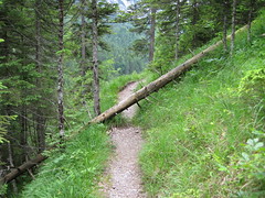
 Track way partialle damaged.
An unknown snake that Mieko and Mike discovered on the track; maybe, it was after the kaulquappen in the puddles.
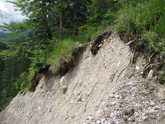
Impressive Klamm.
Johannestal entrance with the bus stop.
Track way partialle damaged.
An unknown snake that Mieko and Mike discovered on the track; maybe, it was after the kaulquappen in the puddles.
Impressive Klamm.
Johannestal entrance with the bus stop.
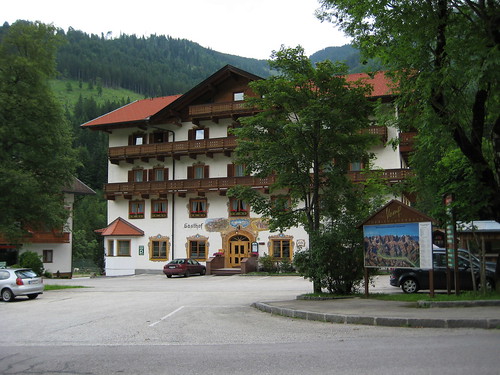
On the road heading towards the Gasthof Herzoglicher Alpenhof for a bear, but very disappointing–it was closed. We once again ate the good things we found in our rucksack; there would be enough time at Munich main station to buy soemthing.